The Murray River
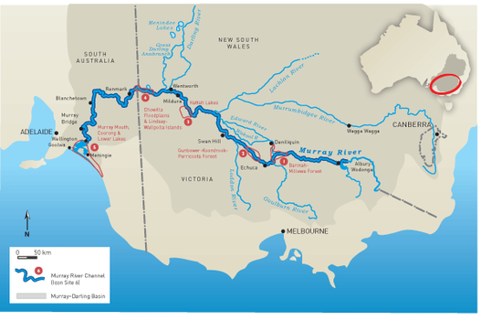
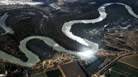
With a total length of 2520 kilometres, The Murray River is the world’s third longest navigable river spanning Victoria, New South Wales and South Australia and four major dams, 16 storage weirs and 15 navigable locks. The Murray River is the main water supply for over 1.5 million households and has been occupied by Aboriginal communities over the past 40,000 years. The Murray River is approximately 130 million years old and flows from the Snowy Mountains in New South Wales through to the Southern Ocean in South Australia. During colonisation in the nineteenth century the Murray River was essential for transportation and irrigation which still stand as two of its numerous purposes today. It is believed that the Murray River was formed over 130 million years ago when Australia was submerged under a shallow sea. When the land start rising out of the sea water flowed from the land back to the ocean which formed what we now know as the Murray River. However, the Murray River was shaped due to the development of the Great Dividing Range, the Murray Basin and the Great Artesian Basin. In my opinion the Murray River is a significant geographic feature of Australia as it is a crucial source of water from numerous households throughout Australia and flows through extremely hot, dry areas which often have very little water and rainfall. Before roads and railways were built the Murray River played an extremely important role in the transportation of goods throughout Australia and between each country, the Murray River is one the Australia and the World’s most significant geographical features and will be for centuries to come.
|
Adelaide Now: http://www.adelaidenow.com.au accessed 6/08/14.
|
Wiki media: http://www.commons.wikimedia.org.au accessed 6/08/14.
